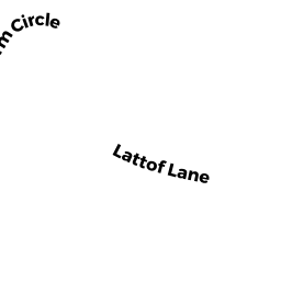
1 LATTOF FARM CIR
Owner Information
LATTOF JOSEPH T
1 LATTOF FARM CIR
ROCKPORT, MA 1966


Property Details
1 LATTOF FARM CIR is classified as a Single Family Residential (Colonial).
The primary structure on this property was built in 2004. There are 4,740ft2 of built area within this property. There is 2,632ft2 of residential/living space within this property. This property is listed as having 6 rooms.
1 LATTOF FARM CIR is valued at $619,700. The land is valued at $206,500 and the structures are valued at $397,800. There is an additional valuation of $15,400 on this property.
The most recent deed for 1 LATTOF FARM CIR is recorded at the local registrar in Book 22423, Page 185. 1 LATTOF FARM CIR was last sold on Monday, February 23, 2004 for $1.
Assessment data from fiscal year 2021.
Flood Data
According to the FEMA National Flood Hazard Layer, this property does not appear to be in a flood zone. It may also be in an area not yet reviewed. Nonetheless, confirm this information prior to taking any action.
To view the flood hazards around this property, create a FEMA "Firmette" Map of the area around 1 LATTOF FARM CIR.
Broadband Internet Providers
| Provider | Type | Bandwidth (mbps) | |
|---|---|---|---|
| T-Mobile | Fixed Wireless | 25 | 3 |
| HughesNet | Satellite | 25 | 3 |
| VSAT Systems, LLC. | Satellite | 2 | 1 |
| Verizon New England Inc. | DSL | 15 | 1 |
| Comcast | Cable | 1000 | 35 |
| Fusion Cloud Services, Inc. | Copper Wire | 0 | 0 |
| Viasat Inc | Satellite | 100 | 3 |
| GCI Communication Corp. | Satellite | 0 | 0 |
Broadband service provider data from December 2020.
Adjacent Properties
- 1 LATTOF LN
Single Family Residential owned by RICHARDS JOHN T JR - 197 MAIN ST
Other, Open Space owned by MCCORMICK FRANCIS JR - 197 MAIN ST #A
Residential Condominium owned by NOBLE JANE P TRS L/E - 197 MAIN ST #B
Residential Condominium owned by GIOVINO FRED - 183 MAIN ST
Motels owned by LOCAL YOKEL LLC - 3 LATTOF FARM CIR
Single Family Residential owned by BOUCHIE STEPHANIE